• Skip to main content

Cut Lunch Adventures

TREK | LEARN | ENJOY

  • Adventure Resources
    • 1. Adventure Ideas
    • 2. Trek Preparation
    • 3. On Adventure
    • 4. Post-Adventure
    • Tools & Calculators
    • Insurance for Trekking and Mountaineering
      • Insurance for Trekking and Mountaineering
      • Insurance for Australians
      • Covid Insurance
    • Shop
    • Useful Links
  • Where To Go
    • Trek Finder Wizard
    • Himalayas
    • New Zealand
    • Australia
    • North America
    • South America
    • Europe
    • Asia
    • Middle East
  • Self Discovery
  • Fun
  • About
    • Our Story
    • How We Can Help You
    • Testimonials
    • Why Cut Lunch?
  • Contact
    • Contact Us

Outback

Australia: A cycling tour with a twist

Published April 2021 by Trevor. Updated December 2021.

Our good friends from Bespoke Cycle Tours recently invited us to join them on their Orange Regional Discovery Tour in Western NSW, Australia. Covering some 300km over six days, with a few steep ascents and descents thrown in for good measure, we were somewhat hesitant to join given we are not cyclists. The last time I or my partner had ridden a bike, for any length of duration, was a few years ago over in Europe. But that was on the flats.

However, when it was mentioned that there would be great food mashed in with a few vineyard tastings along with some boutique accommodation, we were in.

Orange Cycle Tour
Itinerary:
  • Day 1 – Orange to Millthorpe
  • Day 2 – Millthorpe to Carcoar
  • Day 3 – Carcoar to Cowra
  • Day 4 – Cowra to Canowindra
  • Day 5 – Canowindra to Cudal
  • Day 6 – Cudal to Orange
Gourmet food and wine
Gourmet food and wine – delicious!

Day 1 – Orange to Millthorpe

Commencing in Orange, our first port of call was a vineyard – not a bad way to start. Then it was a fairly easy ride along back roads to Millthorpe, some 33 kms. Relaxing over some more wine and tapas over dinner, you could be excused for thinking this is going to be pretty cruisy. Getting a run down over what to expect over the next few days, my thinking became less clouded. I will have to pedal harder.

Cycling with the group through beautiful countryside
Cycling with the group through beautiful countryside (photo: Bespoke Cycle Tours)

Day 2 – Millthorpe to Carcoar

After breakfast, we prepared ourselves for the 63km cycle to the historic village of Carcoar. This was to be our longest cycling day. Better to get it out of the way now than later, I thought.

Unfortunately, the weather gods decided not to play ball. The rain began to pelt down, which was going to make for some uncomfortable riding. Plus having to keep a watch out for trucks travelling at great speed. Being lit up like a ‘christmas tree’ was going to be the order of the day. That and the odd coffee stop or two.

  • Old shed
  • Bull in paddock

Not being very competitive, I tested my mettle against a couple of pro cyclists. So, going downhill I let it rip. I had to finally slow down when a traffic sign stated ’75km/h ahead’. That and the possibility of receiving a speeding ticket from the local constabulary.

Carcoar Railway Station

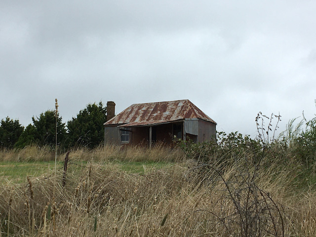
The tiny historical village of Carcoar is amazing. With a one hat Italian restaurant, a local pub plus another quaint cafe that used to be the post office, this tiny town is certainly worth putting on your list for a must visit.

Old machinery at Historic Carcoar
Old farmyard machinery at Carcoar
Historic Carcoar
Historic Carcoar

Day 3 – Carcoar to Cowra

After viewing the weather and our intended route along a main road, we decided along with the rest of our group to hitch a lift. With our bikes in tow, we then proceeded to drive the short 12km to our next stop. Judging by all the passing trucks, spraying lots of water as they went along the road, that decision was very wise.

Upon regrouping, we then proceeded to cycle some 25 kms to our next stop – a roadside picnic, resplendent with table cloth, chairs and fulfilling food.

Roadside Picnic
Roadside Picnic

With our hunger and thirst quenched, it was a short ride into the historical town of Cowra. Here, the majestic Japanese Gardens are a must see along with the adjacent Cowra POW camp. This was the site which housed Japanese prisoners of war captured by the allies during WW2. It’s also the site of the infamous Cowra breakout. This occurred on 5 August, 1944 when 1,104 Japanese prisoners of war attempted to escape. During the escape and ensuing manhunt, four Australian soldiers and 231 Japanese soldiers were killed.

Japanese Gardens at Cowra

Day 4 – Cowra to Canowindra

Cowra marked the half way point of our cycling odyssey. So, it was onwards and upwards across lovely backroads riding some 45kms to Canowindra. However, rather than a coffee stop, this time we dropped into the versatile and interesting Rosnay Organic Farm and Winery. After sampling organic wines and food, we went behind the scenes to observe wine fermenting in the vats. Of course, another sample or three were to be had. No visit would be complete without meeting the inspiring an enchanting Pennie Scott, aka ‘the bush goddess’. Beware though, if you get into a political discussion with Pennie, you had better come prepared!

Cycling in regional NSW
Cycling through big open countryside

Day 5 – Canowindra to Cudal

53kms to ride today – yay. I’m finally getting the hang of this cycling. Coffee, vineyard, flying downhill and then struggling uphill. You’ve got to burn off all those calories somehow. Anyhow, I digress.

Before departing Canownindra, we toured the local wool grading and sales facility located on the outskirts of town. Harking back to my rural days residing in country Western Australia, it was great to be amongst all that wool vernacular again.

Wool grading shed
Learning about wool grading

The highlight for me and others, was visiting a family farm in Cudal with hosts Jock and Tina, along with their two lovely children and pet kangaroo. To meet this passionate family who care so deeply about the land was such a delight. I wouldn’t be too surprised to hear more about them in years to come.

Pet Kangaroo
Yakka, the pet kangaroo

Day 6 – Cudal to Orange

Final day – 47kms, but all up! The reward for our some 15kms steep ascent was – another vineyard and picnic lunch. Now, I’m not too sure whether it was the wine or lunch or both, but the ‘stroll’ back into Orange felt like a doddle.

So, after six days and some 300kms, we were back to where it started. Sporting a few scratches and counting the bottles of wine we purchased along the way, we settled in to a nice restaurant for the night content on finishing off what was a most enjoyable cycling tour with some new found friends.

Onwards and upwards!

Trevor

If you liked this story about our cycling tour, check out this cycling adventure in Dungog, NSW or some of our other blogposts about adventures in Australia.

Australia: Hiking the Ormiston Gorge, Macdonnell Ranges

Published October 2018 by Trevor. Updated July 2020.

Hiking the Ormiston Gorge in winter provided the perfect backdrop to explore this lovely area in the Macdonnell ranges. We found that the Ormiston Gorge is a huge amphitheatre surrounded by hills and ridges. Massive geological forces created the towering red walls of the Gorge and is full of colour.

Vivid colours of the red rock and blue sky

Within Ormiston Gorge, there is a permanent waterhole. This is estimated to be at least 14 metres deep. In the hot summer months, it provides for a refreshing end to a day’s exploring.

Billabong
Billabong (waterhole)

The seven kilometre long Ormiston Gorge walk is a full circuit from the visitor centre. Heading in a clockwise direction, you head up a well made trail section with a few stairs up onto a ridge which provides you with panoramic views, down across the rocky slopes, onto the flat floor of the pound and returns along the gorge via the main waterhole.

View from the lookout looking down into the Gorge

Hiking the full circuit will take you around four hours.

You can undertake this walk at any time of the year. In summer, the heat can be oppressive which makes the waterhole crossing that much more enjoyable as the water is best described as freezing. Once you cross over the waterhole you can continue along the creek bed back to Ormiston Gorge or take the alternate faster route via the Ghost Gum walk. This provides for great views back through the gorge you have just walked and back towards the Ormiston Gorge complex.

Billabong towards the end of the trail near the Visitors Centre

Getting There

Ormiston Gorge is situated 135km (84mi) west of Alice Springs in the Tjoritja/West MacDonnell National Park. Access is via Larapinta and Namatjira Drives. The Visitor Centre is approximately 8kms from the Ormiston Gorge turn-off on Namatjira Drive. Sealed roads provide access by conventional vehicles. Note, some roads can be impassable for a short period after heavy rain.

Onwards and upwards!

Trevor

Striking colours of the outback landscape
Striking colours of the outback landscape.

Insights

  • The West MacDonnell National Park is accessible all year round. The cooler months (April to October) are the most pleasant.
  • The Ormiston Gorge trailhead forms part of the famous Larapinta Trail. It even comes with a kiosk providing coffee and cake!
The well-known Larapinta Trail goes through this area.
  • The gorge has a waterhole that is there all year round and is great for swimming, especially in warmer months.
Amongst the trees near a billabong (waterhole).
  • But remember that most swimming holes are very cold so be careful swimming at any time of year. Long exposure, even in summer, can lead to hypothermia.
  • Ormiston Gorge Ranger Station phone: + 61 8 8956 7799. Contact Parks and Wildlife Alice Springs for more tourist information. Kiosk phone: +61 8 8954 0152
The trail winds through the base of the Gorge
The trail winds down into the base of the Gorge

Australia: Uluru not just any rock

Published August 2018 by Trevor. Updated December 2019.

In this post:
  • Getting there
  • About Uluru
  • Insights

Uluru, also known as Ayers Rock, is more than just a rock!

"<yoastmark

Getting there

The nearest large town is Alice Springs, some 450km and 4 1/2 hours drive away. You can base yourself there and do a day trip there and back, either using your own transport or utilise a tour company and let them do the driving for you. We chose the latter as it was a more relaxed way to travel.

The other way is to incorporate the visit into your itinerary heading south. There are a few places you can stay, either within the park or just outside.

About Uluru

Uluru is a massive sandstone monolith in the heart of the Northern Territory’s arid ‘Red Centre’.  It is s acred to indigenous Australians, thought to have started forming around 550 million years ago.

Located within Uluru-Kata Tjuta National Park, you will also find the 36 red-rock domes of the Kata Tjuta (colloquially “The Olgas”) formation.

"<yoastmark

Approaching Uluru, the one thing that stands out, aside from it’s sheer size rising out of the ground, is its varied red colours.  More so at sunset. Walking around its circumference takes around 3 1/2 hours which is a must if you have the time. It is only then when you look up, that you can see the various rock formations and its sheer beauty.

"<yoastmark

Approximately 15 minutes away, are the 36 red-rock domes of the Kata Tjuta (“The Olgas”) formation – another beautiful area in its own right.

The Olgas
The Olgas

Uluru is a living cultural landscape. It’s considered sacred to the Yankunytjatjara and Pitjantjatjara people. The spirits of the ancestral beings continue to reside in these sacred places making the land a deeply important part of Aboriginal cultural identity.

Onwards and upwards!

Trevor

Insights

  • Elevation is 863m, and the circumference is 10km.
  • Uluru is the name in a local Aboriginal language (Arrente), and since the 1980s has been the officially preferred name.
"<yoastmark
  • Many people, especially non-Australians, still call it Ayers Rock.
  • It’s considered to be the world’s largest monolith. A monolith is a large, single block of stone.
  • This is also an Aboriginal sacred site and Australia’s most famous natural landmark.
The Olgas
Short walk to the base of the Olgas
  • The oxidized iron in the sandstone gives the rock its rusty-red colour.
  • Note: Climbing the sacred site has now been banned (since 26 October, 2019). Prior to this it was discouraged in order to respect the local culture. However many people still climbed the rock which can be dangerous to do. Since record-keeping began, there have been 37 fatalities. On the last day it was open there were queues of people waiting to climb for the last time.
Uluru
You can just make out people climbing the rock.

Australia: Nullarbor Road Trip – Flat as a pancake, as far as the eye can see

Published February 2017 by Trevor. Updated December 2019.

In this post:
  • Introduction
  • Local flora and fauna
  • Heading from East to West
  • Heading back home – West to East
  • The locals
  • Broken Hill and Mad Max
  • Whales
  • ANZAC Centre
  • Karri Trees and Pinnacles
  • Insights

Introduction

I first did the Nullarbor road trip back in 1978 travelling from the West coast of Australia to the East coast and back again. Some 40 years later, nothing has changed. However, it’s never boring. 

Australia’s longest straight road on the Nullarbor road trip

Local flora and fauna

It had it all. Long straight roads (the straightest section is around 146km/91mi). Lots of native Australian wildlife consisting of  kangaroos, wombats, emus, rabbits, wedge tail eagles and camels. The camels came courtesy of the Afghans who brought them out during the gold rush days of the 1800’s. Plus pesky flies which appeared out of nowhere when you stop alongside the road, obviously looking for a ‘good feed’. Oh well, at least this allowed us again to practice the great Aussie salute. 

Only 4111km to go

Heading from East to West

My partner had just become an Australian citizen. So I thought it was timely to formally introduce her to the ‘great Aussie road trip’. With a few months of planning, we set off from Sydney on a crisp but nice sunny morning. Heading in a westerly direction, we plotted a course: Sydney-Mildura-Streaky Bay-Eucla-Esperance-Albany-Margaret River-Perth.

Feeling outnumbered at Cocklebiddy
A long way from anywhere at the Eucla roadhouse

Heading back home – West to East

After a few days break, we headed East back home to Sydney: Perth-Kalgoorlie-Eucla-Port Augusta-Broken Hill-Dubbo-Sydney. In total, we covered around 10,000km (6,214 mi). Surprisingly,  time went quick and it was loads of fun – at least I didn’t have to listen to Barry Gibb and that Bee Gees tape all over again like I did on my first trip.

Mad Max Museum in Silverton, NSW
The famous Silverton Hotel
Mad Max Museum

The locals

The people encountered along the way, conversations you have at the local bar of a hotel coupled with the food were simply amazing (read Aussie Rules football, chicken schnitzel’s and beer). There is definitely something to be said about genuine country folk and the local grub.

Pro Hart Gallery
Kalgoorlie Hotel
Superpit open cut gold mine, Kalgoorlie

Broken Hill and Mad Max

The added bonus of such a road trip wouldn’t of course be without viewing first hand where the Mad Max films were made.  Plus visiting the famous artist Pro Hart’s gallery in Broken Hill; hanging out at the largest open cut gold mine in the world in Kalgoorlie; viewing the remnants of Skylab that fell over Balladonia (US Space station that broke up on re-entry over the outback of Western Australia); playing the longest golf course in the world and walking along the majestic coastline of Esperance with it’s icing sugar white sand that squeaks between your feet and lots off granite islands as far as your eye can see.

Whales

We also enjoyed many natural sites and some unnatural. Such as viewing whales and their calves frolicking 50m from the huge limestone cliffs just off the road along the Eyre Peninsula and witnessing wedged-tail eagles with the road kill from the passing road trains.

Whales at the Head of the Bight
ANZAC memorial
Coastal cliffs along the Nullarbor

ANZAC Centre

We also visited the National ANZAC centre in Albany where soldiers from Australia and New Zealand (some 41,000) gathered in the port city in 1914 to set sail in a convoy of ships to the Mediterranean during the First World War.  Sadly, for a majority of them, this was the last time they ever got to see the shores of Australia.

The Pinnacles

Karri Trees and Pinnacles

We marvelled at the towering Karri trees of the Western Australia State Forrest, sampled the famous red wines from Margaret River, saw the famous Pinnacles north of Perth where the weathered rock spires rise out of yellow sand dunes. Of course no road trip would be complete without having your fruit seized at a local fruit quarantine check point in South Australia (fruit fly zone).

The trip was finally topped off by bumping into a bunch of road bikers heading up through central Australia on their way to Cairns, Queensland via the infamous Birdsville Track. Only to discover that during a conversation you went to school with them some 40 years earlier (we had only changed slightly). It really is a small world after all.

Onwards and upwards!

Trevor

Insights

  • Head off before dawn if you can. It’s the nicest time of the day with the sun rising in the East, plus it’s cooler that way in the hotter months (December to March).
Sunrise over the old tanker jetty in Esperance
  • Watch out for Kangaroos, especially the hour before dawn and after the sun sets at night. They can be easily startled in your headlights and you don’t want to hit one at high speed. Least of all it could mean the end of your trip – for you and the kangaroo.
  • Road trains are encountered regularly along the Eyre Highway (towing sometimes up to three trailers) as well as the numerous ‘grey nomads’ towing a caravan or trailer. Be careful to allow space and distance in passing and don’t forget to wave to oncoming traffic – an outback Aussie tradition.
Road Train
  • Fuel and bottled water is readily available, but be careful of the section between Balladonia and Caiguna. This section includes the longest straight stretch of road in Australia and one of the longest in the world. The road stretches for some 145.6 km (90.5 mi), signposted and commonly known as the ’90 Mile Straight’. Obviously, the further you are away from a major city or town centre, the cost of fuel will increase but on our trip the most we paid was around $1.80 AUD per litre (unleaded petrol), but have seen it as high as $2.30 AUD per litre – diesel is much more expensive.
  • Autumn and winter months (April-August) are the best times to travel across the Nullarbor as the Summer months (December-February) can be very hot (40 plus degrees Celsius/104 degrees Fahrenheit). If you do choose to drive across during summer, take extra water with you.
White sands near Esperance
Esperance beach
Kangaroo on the beach at Esperance
  • Accommodation is basic and can be expensive by local standards. Unfortunately that’s what you get for staying in a remote area.
  • Located near the Nullarbor Plain in Western Australia’s far east coast, the Head of the Bight is one of the best whale-watching sites in the world – 20km (12.4mi) to the east of Nullarbor Roadhouse. It’s known for its impressive land-based viewing of whales migrating up from Antarctica. During whale season, pods of 70-tonne Southern Right Whales and their calves can clearly be seen frolicking along the cliffs.
  • Also, during the whale migration season, it’s not uncommon to see other Southern Right Whales (watch out for their water-spout) coming along the Eucla Highway, heading towards/away from Norseman as the road runs parallel and close to the coast for around 50km (31mi).
Long straight roads
  • The Nullarbor Plain is part of the area of flat, almost treeless, arid or semi-arid country of southern Australia. Located on the Great Australian Bight coast with the Great Victoria Desert to its north.
  • Now, about those Camels. Another unknown fact is that Australia is the largest exporter of camels to the Middle East for racing purposes. Now there’s a juxtaposition if ever I’ve heard one.
  • If you want to read more on the outback of Australia, see our post on Uluru.
  • Terms of Use
  • Privacy Policy
  • Disclosure

© 2026 · Cut Lunch Adventures