If you looking for things to do while you’re waiting for your next adventure then play Adventure Bingo! Whether you’re in lockdown, stuck with travel restrictions, or just in between adventures then here are some ideas.

TREK | LEARN | ENJOY
If you looking for things to do while you’re waiting for your next adventure then play Adventure Bingo! Whether you’re in lockdown, stuck with travel restrictions, or just in between adventures then here are some ideas.
Our good friends from Bespoke Cycle Tours recently invited us to join them on their Orange Regional Discovery Tour in Western NSW, Australia. Covering some 300km over six days, with a few steep ascents and descents thrown in for good measure, we were somewhat hesitant to join given we are not cyclists. The last time I or my partner had ridden a bike, for any length of duration, was a few years ago over in Europe. But that was on the flats.
However, when it was mentioned that there would be great food mashed in with a few vineyard tastings along with some boutique accommodation, we were in.


Commencing in Orange, our first port of call was a vineyard – not a bad way to start. Then it was a fairly easy ride along back roads to Millthorpe, some 33 kms. Relaxing over some more wine and tapas over dinner, you could be excused for thinking this is going to be pretty cruisy. Getting a run down over what to expect over the next few days, my thinking became less clouded. I will have to pedal harder.

After breakfast, we prepared ourselves for the 63km cycle to the historic village of Carcoar. This was to be our longest cycling day. Better to get it out of the way now than later, I thought.
Unfortunately, the weather gods decided not to play ball. The rain began to pelt down, which was going to make for some uncomfortable riding. Plus having to keep a watch out for trucks travelling at great speed. Being lit up like a ‘christmas tree’ was going to be the order of the day. That and the odd coffee stop or two.

Not being very competitive, I tested my mettle against a couple of pro cyclists. So, going downhill I let it rip. I had to finally slow down when a traffic sign stated ’75km/h ahead’. That and the possibility of receiving a speeding ticket from the local constabulary.

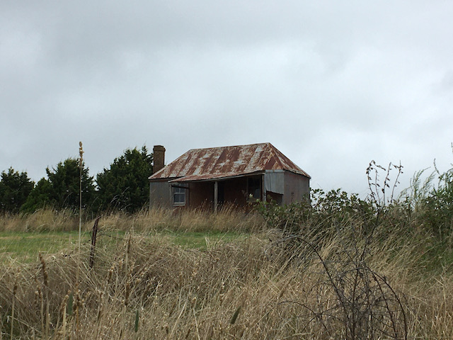
The tiny historical village of Carcoar is amazing. With a one hat Italian restaurant, a local pub plus another quaint cafe that used to be the post office, this tiny town is certainly worth putting on your list for a must visit.


After viewing the weather and our intended route along a main road, we decided along with the rest of our group to hitch a lift. With our bikes in tow, we then proceeded to drive the short 12km to our next stop. Judging by all the passing trucks, spraying lots of water as they went along the road, that decision was very wise.
Upon regrouping, we then proceeded to cycle some 25 kms to our next stop – a roadside picnic, resplendent with table cloth, chairs and fulfilling food.

With our hunger and thirst quenched, it was a short ride into the historical town of Cowra. Here, the majestic Japanese Gardens are a must see along with the adjacent Cowra POW camp. This was the site which housed Japanese prisoners of war captured by the allies during WW2. It’s also the site of the infamous Cowra breakout. This occurred on 5 August, 1944 when 1,104 Japanese prisoners of war attempted to escape. During the escape and ensuing manhunt, four Australian soldiers and 231 Japanese soldiers were killed.

Cowra marked the half way point of our cycling odyssey. So, it was onwards and upwards across lovely backroads riding some 45kms to Canowindra. However, rather than a coffee stop, this time we dropped into the versatile and interesting Rosnay Organic Farm and Winery. After sampling organic wines and food, we went behind the scenes to observe wine fermenting in the vats. Of course, another sample or three were to be had. No visit would be complete without meeting the inspiring an enchanting Pennie Scott, aka ‘the bush goddess’. Beware though, if you get into a political discussion with Pennie, you had better come prepared!

53kms to ride today – yay. I’m finally getting the hang of this cycling. Coffee, vineyard, flying downhill and then struggling uphill. You’ve got to burn off all those calories somehow. Anyhow, I digress.
Before departing Canownindra, we toured the local wool grading and sales facility located on the outskirts of town. Harking back to my rural days residing in country Western Australia, it was great to be amongst all that wool vernacular again.

The highlight for me and others, was visiting a family farm in Cudal with hosts Jock and Tina, along with their two lovely children and pet kangaroo. To meet this passionate family who care so deeply about the land was such a delight. I wouldn’t be too surprised to hear more about them in years to come.

Final day – 47kms, but all up! The reward for our some 15kms steep ascent was – another vineyard and picnic lunch. Now, I’m not too sure whether it was the wine or lunch or both, but the ‘stroll’ back into Orange felt like a doddle.
So, after six days and some 300kms, we were back to where it started. Sporting a few scratches and counting the bottles of wine we purchased along the way, we settled in to a nice restaurant for the night content on finishing off what was a most enjoyable cycling tour with some new found friends.
Onwards and upwards!
Trevor
If you liked this story about our cycling tour, check out this cycling adventure in Dungog, NSW or some of our other blogposts about adventures in Australia.
The following is a useful insight into Oman, which you won’t read in any guidebooks!

I first visited the Sultanate of Oman (Oman) on business during the late 90’s through to the early 2000’s. Of all the places that I have worked in the Gulf, Oman always stood out for me as being the most fascinating and welcoming to a foreigner.

Its ruler for some 25 years, Sultan Qaboos bin Said al Said, recently passed away. So, I thought it was an opportune time to reflect on my time there and key observations.

In Oman, I had the opportunity to do business with the Government and local businesses as well as meet some influential people. Being a foreigner in Oman, I was lucky to be taken under the wing of an important local. He taught me much about the people, trading history and culture. He also encouraged me to explore the ‘interior’ of the country – which I dutifully did.

It’s fair to say much has changed since I was last in Oman. But the people, its rich history, divergent culture and landscape haven’t.
So, what is it about the people, history and culture of Oman that still fascinates me to this day and makes it stand out from the rest of its Arabian Gulf neighbours?

The Sultanate of Oman long served as a hub on the Indian Ocean trade routes, and it has ancient ties that reach from Pakistan to the island of Zanzibar. Today, Oman is one of the wealthiest nations on Earth, despite not having extensive oil reserves.
In 1498, the Portuguese discovered Oman and you can see their influence in some of the architecture.

The people of Oman are very distinctive, in both dress and character as opposed to other Arabs across the Gulf. In fact, I would argue that Omanis are the most friendliest and laid back of all the other Arabs I encountered in my years working in the Gulf.

I was told that Omanis don’t consider themselves officially as ‘Arabs’. Oman, while it’s officially part of the Gulf Cooperation Council (GCC), has more in common with Pakistan, Iran and India given it’s historic trading connections. As an example, most Omanis can speak fluent Hindi, Urdu and English.

Oman is also considered as the ‘honest’ broker’. By that, I mean they often find themselves brokering peace or facilitating meetings between other Arabic countries – even Israel in the past.

While Oman’s economic prosperity has hinged on oil revenues, much has been done to diversify its economy. Tourism plays a big part in this. Some of the best diving and cultural sites in the world can be found in Oman. It’s also a unique location for rock climbing.

Being in close proximity to the likes of the United Arab Emirates, by both road and air, lends itself to both expats and locals visiting both countries on a frequent basis – even just for a weekend.


A book that I would recommend reading, ‘Don’t They Know It’s Friday’, written by Jeremy Williams’. This book helped me immensely in conducting business and successfully gaining the trust of the local Arabs across the Gulf.
Tashi Dele! “Hello, Welcome!”. Our journey through Tibet had started. In the forgotten kingdom of Tibet, much has changed since China took control in 1950. Fast forward nearly 70 years and Tibet is still changing – very rapidly I might add. For the better? Well, that depends on your perspective in terms of how you perceive change.

We visited Tibet to enable us to trek up to Cho Oyu Advance Base Camp with a climbing expedition. Coupled with a visit to Shishapangma Base Camp (North side) plus Everest Base Camp (North).
This was always going to be a ‘trek’ with a difference. Firstly, given the vast distances we had to cover (some 1,400km/869mi), driving was always going to form a large chunk of our trip. As for trekking, well unfortunately this time around it had to play second fiddle. Getting up and over several 5,000m passes certainly helped with the new and improved roads, making for easy access to the interior all of which was a blessing.

The Tibetans are getting on with their lives the best way they can, though are very limited to the type of jobs they can apply for, type of vehicles they can own and are not allowed to travel outside of the Tibet Autonomous Region (TAR). We must have encountered some 30 police or other check points along the way for locals and tourists alike. But hey, the Tibetans can still dance and have some fun as we discovered first hand in Lhasa.

Flying into Lhasa has a certain charm about it, even at 3,700m / 12139ft. Lhasa still maintains a vibrant culture and the food is great. Having a cup of tea at a local tea house with local Tibetans was a real bonus.
Potala Palace, rebuilt in the 17th century, was the winter palace of the Dalai Lamas from 1649 to 1959 and has been a museum since then. Now a world heritage site, its now a bit of a tourist trap. Most if not all of the historical artefacts have been moved back to Beijing for ‘restoration purposes’. Plus, many of the old rooms have been closed to visitors so you are only permitted to wander around inside as the authorities wish.

With hordes of tourists lining up to go in (and this wasn’t even peak season), we chose to walk around the outside as the local Tibetans do on a daily basis. We recommend this! Find where they are dancing and join in. And for good measure, go and exercise with them. You are guaranteed lots of laughs and enjoyment.

From Lhasa we drove to Shigatse, the second-largest city in Tibet. Here, we visited the Tashi Lhunpo Monastery, founded in 1447 by the first Dalai Lama. We were very lucky on the day we visited that the monks were celebrating the end of a prayer cycle. They paraded through the monastery grounds with a great fanfare of Tibetan ceremonial horns and crashing cymbals.
Having trekked to Mt Everest on the South side in Nepal, I have to say I was blown away when I saw Chomolungma from the North side. My first reaction was ‘she’s huge’! My second reaction was how beautiful she looked, even from some 19km away. Having had some friends climb her back in the spring season earlier in the year brought it all home. Being totally exposed to the weather on the North side, it would have been one tough climb!

Base camp (5,200m) was marked with a plaque. Obviously some people hadn’t properly acclimatised, judging by the numerous people around us suffering breathing difficulties. So much so, some were sucking air from a small oxygen canister! Is it a tourist trap? Probably. Is it overrun with local tourists just to tick off a bucket list item and take the obligatory photo? Absolutely. A great example of this was that the majority of people were bussed up and back from Tingri, some 6-8 hours return, making for a long return trip. Instead, we stayed up at Rongbuk, and were rewarded the next morning with some great views. Nevertheless it is still worth making this stop on your Tibet journey.

Wow! Not only did we see Cho Oyu (the ‘turquoise goddess’) close up and personal, we also trekked up to ABC with a climbing expedition. Reaching an altitude of some 5,800m, this was definitely not for the faint hearted. Coupled with the weather, the landscape up high was very stark, consisting of a rocky and snowy terrain.
Higher up, the climbers were stopped in their tracks above Camp 1 (around 6,000m). Deep snow hindered their progress and acclimatisation rotations on the mountain. On top of that, we were all informed that everyone had to exit Tibet by 1 October due to China’s 70th anniversary celebrations. This added considerable angst to the climbing party’s summit schedule. The professionalism of sherpas and climbers prevailed, combined with Climbalaya’s excellent logistics and planning. As a result, successful summits were achieved. This included one climber who planned to ski down from the summit!

You can read more about our trek to Cho Oyu Advance Base Camp here which we did as part of our Project Base8000.

We never thought we would make it! The Chinese had officially closed the mountain to all climbers for the season. Plus the reluctance of our Tibetan driver to almost refuse to drive the some 20kms along a very rocky and bumpy gravel road from where the bitumen road ended. We were then chased down by the ‘park custodian’ who cut us off in our tracks, gesturing and demanding some 1,000 Chinese yuan for our right of passage. ‘But it’s normally free to drive to base camp’, we protested – obviously not on this day it wasn’t.
So, after all that, the easy part we discovered was the drive back to the Tibet/Nepal border, overnighting in Kyirong. Crossing over into Nepal the next morning however, was different. We had to navigate some 6 military check posts plus numerous landslides cutting off the road. Reaching Kathmandu some 9 hours later, tasting our first cold beer and experiencing the first hot shower in 2 weeks – all went down very nicely indeed.
You can read more about our trek to Shishapangma Base Camp here which we did as part of our Project Base8000.

Onwards and upwards!
Trevor

Tromso, being above the Arctic Circle, is often referred to as ‘Paris of the North’ due to its lively atmosphere. Tromso is the world’s most northern university town and the largest city in the Nordic countries north of the Arctic Circle. The city lies between the sharp craggy peaks of the Lyngen Alps and combines wild scenery with urban life.


It’s a common myth that being above the Arctic Circle, you chase the Northern Lights – not true! The Northern Lights are always there, especially in winter, but you need a dark and clear cloudless night to see them. What I didn’t know, is all those lovely photos you see are are in actual fact viewed through an SLR camera with a long exposure and not with the naked eye. Lucky for us, we had one! Apparently, if you also have an iPhone, there is an App for that as well. Anyway, I digress. The greatest chance and frequency to view the Northern lights in winter is between the hours of 6pm-2am.

Patience and dedication pays off … lots of patience and dedication! The Northern Lights might be visible only for a few minutes or most of the evening. They may be faint or very bright, they even may be dancing with green colours or even pink depending on the level of solar activity and how clear the sky is. What is never guaranteed however is that you will get to see them on any given night. The best advice is to have a few spare days up your sleeve just in case – and take lots of warm clothes including boots, with temperatures in winter often dropping down to minus 19 degrees C or lower at night depending on the location.


The notes read, ‘being above the Arctic Circle you will enjoy the arctic coastal nature with a fantastic view over Tromso’. No mention that there would be near whiteout conditions with snow blowing in your face from every conceivable angle.
After meeting our driver and team of 12 Alaskan Huskies and much barking, we set off on the exhilarating ride ahead. Tucked under a warm rug on the sled certainly helped to keep warm.

Having come straight from an Australian summer, it was also a test of human endurance, but not the dogs though. In fact, Alaskan Huskies are bred for their endurance and stamina are renowned for their work ethic in a harsh, windswept snow environment.

They are trained from a young age to be sociable and interact with humans. Consuming some 6,000-8,000 calories a day when working, their diet mostly consists of high protein foods like salmon.

There is a strong interaction between the driver of the sled and the lead dogs, who are the most experienced and understand commands from the driver – in Norwegian of course. Working as a team, they will sense when the driver is not assisting with the sled and slow down or stop right in their tracks.
Above the Arctic Circle, this day is was what we call in the business, a ‘bluebird day’. Blessed with perfect weather in twilight conditions, we set off mid morning for a 3 hour hike and explored the surrounding wilderness area situated on Kvaløya Island.

With views back over Tromso and towards the Fiords, snow crunching below our feet, it was a majestic day.

Onwards and upwards!
Trevor

Other attractions/activities to do in Tromso:
